June 27, 201015 yr I've heard some mentioning of "exit 38" around here and was curious to know if this was exit 38 on I90? I was heading over to Cle Elum to view a house to move into and we were driving across I90 and I saw exit 38 one mile. Its roughly 50 miles from a house I may be moving into. So some clearification would be extremely appreciated. Maybe even tell me a couple things about exit 38? I've sold my hardcore wheelers that were covered in dents but i don't mind doing a little wheeling in my newer subaru. thanks all:) -cody
June 28, 201015 yr well, from what i heard .its mainly logging roads.and legal. http://www.ultimatesubaru.org/forum/showthread.php?t=113195&highlight=monstaru but as with any new area to you,be considerate.please do not be disrespectful to places that are not marked as trails. it is hard enough keeping our name proper as hardly any of the four wheeling community recognizes what we do .it is all bigger and better out there. don't be a fool....... and everything should remain OK. respect where ever you go.please.cheers, brian
June 28, 201015 yr Exit 38 has some logging roads and such, its also a very popular rock climbing crag when its dry. For some light wheelin you might want to check this out http://nwjeepn.com/WAtrails.htm#cleelum got some good trails out your back door if you do move to cle elum. -Andy
June 28, 201015 yr Author Exit 38 has some logging roads and such, its also a very popular rock climbing crag when its dry.For some light wheelin you might want to check this out http://nwjeepn.com/WAtrails.htm#cleelum got some good trails out your back door if you do move to cle elum. -Andy Have you personally been to any of these trails? I'm used to muddy trails and deep ruts in dense forest. It sounds like we may be doing some wheeling in the coming days. -cody Edited June 28, 201015 yr by sube4x4
June 28, 201015 yr Havent been on any yet, my Brat isnt running right now. But when its going again i will be checking out as many trails as i can in the cle elum/liberty area before winter (a lot of the trails close for winter). Always up for some wheelin so just let me know -Andy
June 30, 201015 yr I go up there all the time, take a few google maps with me when I do. It's got some creeks you can drive through and some trails have washed out roads. The views can be nice, and some spots pose challenges for a stock wagon.
June 30, 201015 yr I go up there all the time, take a few google maps with me when I do. It's got some creeks you can drive through and some trails have washed out roads. The views can be nice, and some spots pose challenges for a stock wagon. i hope that is condoned by whatever agency the land is owned by.....i would check if you don't know.cheers, brian
June 30, 201015 yr i hope that is condoned by whatever agency the land is owned by.....i would check if you don't know.cheers, brian hmm, well it goes across the road, there aren't any ways around it.
July 1, 201015 yr regardless. on any property your on in the state of washington,it is YOUR personal responsibility (per state law) to know what type of land you are on, that is my point. just because someone cut a road in somewhere does not mean YOU are supposed to be on it.don't be ignorant .be informed. because if it IS illegal to be in that part of the area, crossing a stream, it can not only shut down an entire area(per particular agency), it can also shut down other areas . all from peoples stupidity , and disregard towards rule layout and or enforcement.
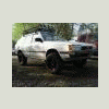
July 1, 201015 yr Yeah well, I'm new to this whole thing. Just got the wagon in December so this is my first season. Btw, this is NOT Olallie state park, I just used that designation to get me to the exit 38 access roads. This is where I'm talking about.
July 2, 201015 yr your ignorance is not an excuse to any agency, or the people that work hard to keep areas open .i am just stating that you need to be educated about where you go.since you ARE new, i would suggest researching before you go anywhere to "offroad".....cheers, brian
July 2, 201015 yr According to that map, its Federal land. If the Feds dont wanting you crossing/fording the streams, I suspect they will either post a sign or close the road down. I've been in that area and there are several stream crossings. When it rains heavy or the snow is melting, there are creeks running every where. But please tread lightly.
July 2, 201015 yr Search out the local forest service websites. Search out the local DNR websites. Scour local 4x4 club websites. Then search for any info on those websites pertaining to the area you wish to travel. Alot of closed/open info gets buried in PDF files as reports, press releases, and land use planning. A local area to me had me searching for a few nights online for the reports I was looking for that stated what was open and not. (turns out most of it was, but just in the past few months is no longer) It's alot of reading, some of it is pages and pages. But I've found many times that an area that was unmarked in the real world turned out to be off limits after reading what seemed to be a book on the plans for an area. I then quit even going near the area. Remember. These days the law is "If it's not marked as "open", then its to be considered closed." As in: Trails you are allowed on will have some sort of trail marker. If not you run the risk of punishment ranging from a warning, to a vehicle impound. There are a few open OHV areas I do know of. At those you can drive on any trail within the area boundaries marked or not. But it is very rare. Just how it is. I don't make the rules. Just try to follow as many as I can find. Only way we are gonna have any trails tomorrow, is if we respect the trails today. If the majority had it their way. There would be no such thing as wheeling. Up to us to show them we can enjoy the forests responsibly in our 4WDs. Sorry for a rant. But I've seen areas near me that had a few trails the rangers said they didn't care that we used get totally shut down due to a few new and abused user made trails in the area. Or abuse of a sensitive area like a meadow or stream. Edited July 2, 201015 yr by TeamCF
July 5, 201015 yr Search out the local forest service websites.Search out the local DNR websites. Scour local 4x4 club websites. Then search for any info on those websites pertaining to the area you wish to travel. Alot of closed/open info gets buried in PDF files as reports, press releases, and land use planning. A local area to me had me searching for a few nights online for the reports I was looking for that stated what was open and not. (turns out most of it was, but just in the past few months is no longer) It's alot of reading, some of it is pages and pages. But I've found many times that an area that was unmarked in the real world turned out to be off limits after reading what seemed to be a book on the plans for an area. I then quit even going near the area. Remember. These days the law is "If it's not marked as "open", then its to be considered closed." As in: Trails you are allowed on will have some sort of trail marker. If not you run the risk of punishment ranging from a warning, to a vehicle impound. There are a few open OHV areas I do know of. At those you can drive on any trail within the area boundaries marked or not. But it is very rare. Just how it is. I don't make the rules. Just try to follow as many as I can find. Only way we are gonna have any trails tomorrow, is if we respect the trails today. If the majority had it their way. There would be no such thing as wheeling. Up to us to show them we can enjoy the forests responsibly in our 4WDs. Sorry for a rant. But I've seen areas near me that had a few trails the rangers said they didn't care that we used get totally shut down due to a few new and abused user made trails in the area. Or abuse of a sensitive area like a meadow or stream. Good information. All of you should follow this... as an example of how to post, and how to find information about local wheeling. The best advice is to only wheel at designated ORV areas. Walker Valley, Reiter pits, Evans Creek, elbe Hills, Tahuya... At least that way you know you are legal and do not jeopardize my ability to wheel.

Please sign in to comment
You will be able to leave a comment after signing in
Sign In Now